
Intermittent visits
Spot measurements that miss what happens between one campaign and the next.
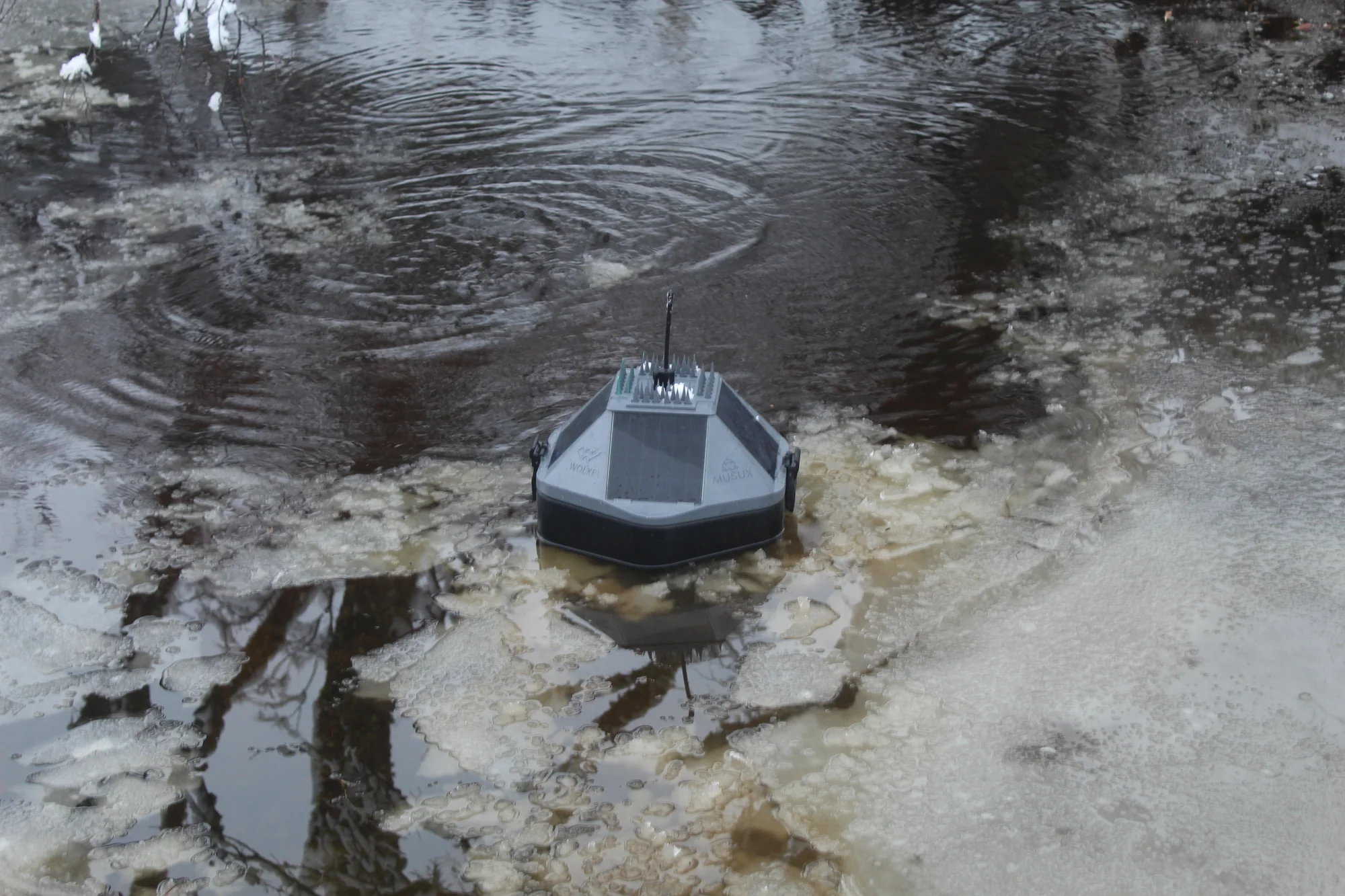
Campaigns vs. a continuous time series.MUSUX is our floating monitoring platform: it combines sensors, solar power, an onboard VigiaBOX, and communications to observe ponds, tailings, process water, and remote water bodies continuously.
It is not a closed buoy with fixed sensors. It is configured around the water body, the variable that matters, and the system that has to receive the data.
Sensors, communications, and integration are configured for each water body.
In critical water infrastructure, the problem is not just measuring. It is sustaining observation when access is difficult, power is limited, signal strength varies, and manual visits leave gaps.
Spot measurements that miss what happens between one campaign and the next.
Campaigns vs. a continuous time series.Tailings, wetlands, bays, channels, coastal zones, and hard-to-reach intakes.
Access, power, and signal.Sensors and systems that do not talk to operational, environmental, or regulatory platforms.
Records that do not reach decision-makers.Without continuity, decisions in operations, compliance, and environmental management rest on incomplete information.
Deciding with data gaps.MUSUX adapts to the problem: it integrates the sensors each project needs (water quality, echo sounder, or level) and sends the data to GeoVigía or to your infrastructure.

Integrated panels for off-grid operation, sized to the sensors, measurement cadence, and solar radiation at the site.
It reads the sensors, backs up the data locally, and transmits it. Configurable measurement and transmission rates; pending data is resent automatically after a link outage.
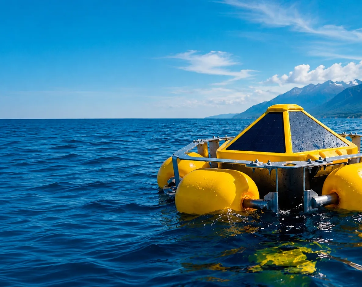
Impact protection, buoyancy, and stability in demanding conditions. A protective cage for the sonde and attachment to the site's mooring system.
Modbus RS-485, SDI-12, and analog interfaces to integrate the instruments each water body requires.
MUSUX runs on the same foundation as every other Wolke product: data acquisition and backup in VigiaBOX, whatever network the site has, and traceable delivery through the Connection Broker.
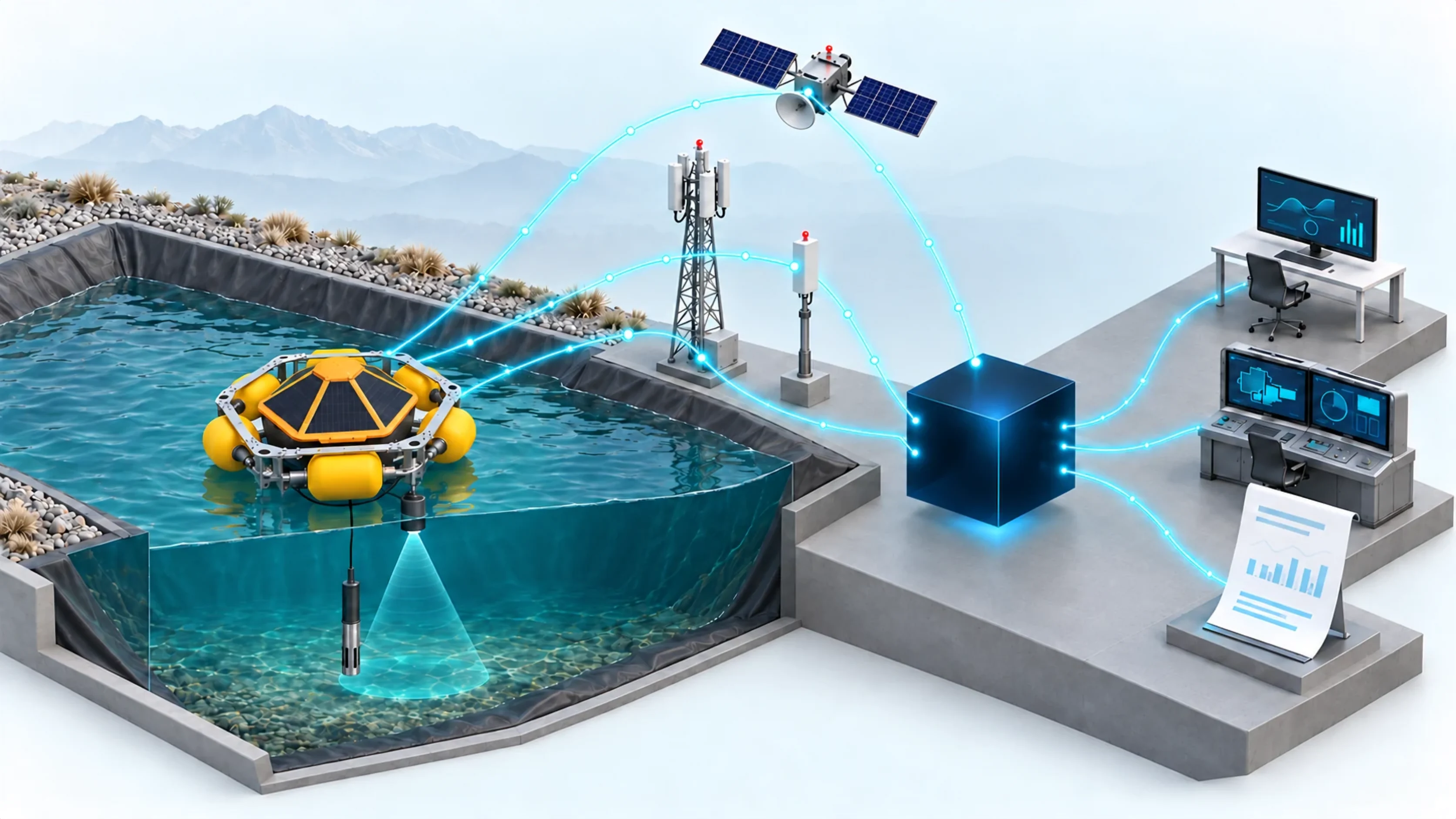
Sensors
MUSUX
Site network
Connection Broker
Your operation
Sensors
Multiparameter sonde and echo sounder, chosen for each water body.
MUSUX
Floating platform with VigiaBOX on board, solar power, and local backup.
Site network
Cellular, LoRaWAN, or satellite, depending on the location.
Connection Broker
Keeps the original, interprets it, and delivers with full traceability.
Your operation
GeoVigía, your systems over API, MQTT, or SCADA, and scheduled reports.
Field diagnostics are done from the MUSUX app over Bluetooth Low Energy, with no data coverage required.
One platform, configured around the question the operation needs to answer.
IP68 multiparameter sonde (RS-485) to track physicochemical trends: pH, conductivity, temperature, ORP, turbidity, and dissolved oxygen.
Echo sounder for local depth and the water column. Depth checks in areas of operational interest and support for bathymetric surveys.
MUSUX alongside the RokkaBOX-instrumented embankment, weather data, water reclaim, and environmental monitoring, in a single view.
It does not replace a bathymetric survey of the entire bottom or laboratory sampling: it complements both with continuity between campaigns.
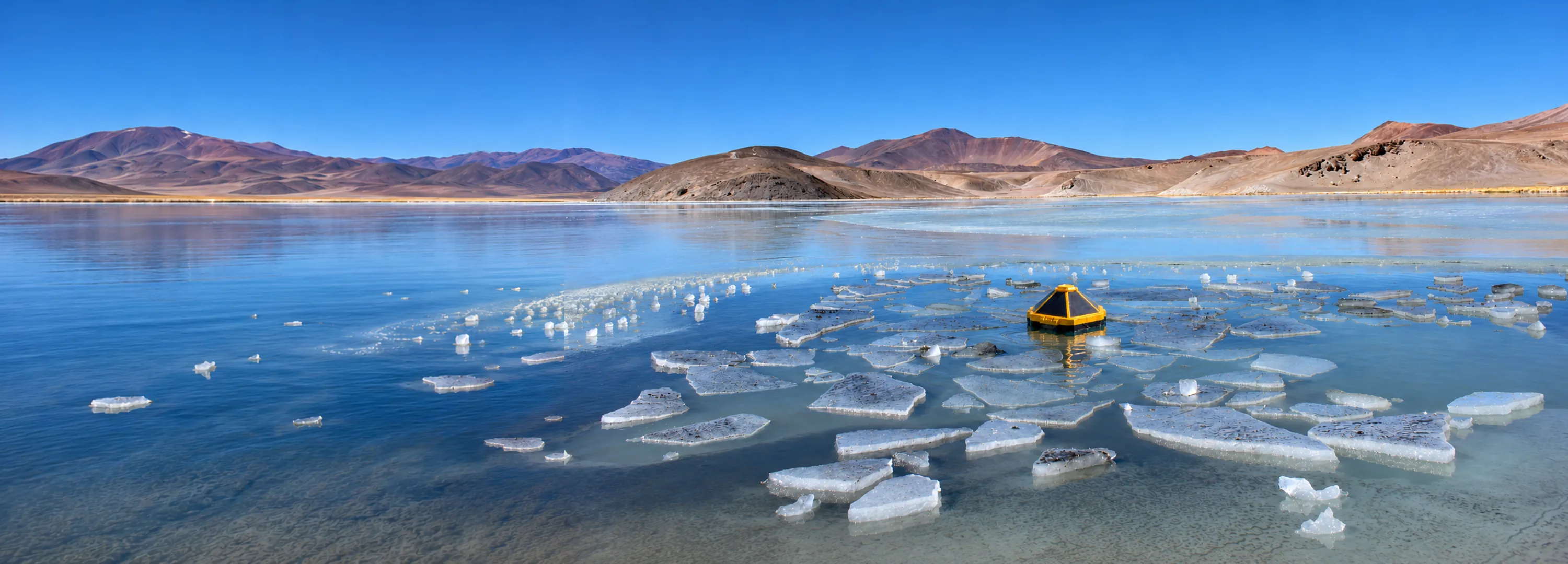
From tailings ponds in northern Chile to wetlands and coastlines in the south: the same platform, configured for each water body.
Ponds, reservoirs, and process water where environment, operations, and risk intersect. Multi-unit networks with echo sounders and water quality sensors.
Intakes, discharges, and coastal zones linked to marine water infrastructure.
Dynamic water bodies, difficult access, and exposure to the elements.
Low impact, continuity, and evidence for land management.
Reservoirs, canals, pumping stations, and plants: level, flow, and water quality.
MUSUX began in a public innovation challenge for wetland conservation and now operates in tailings, desalination, and oceanography. It has been validated in icy, high-altitude, windy, and saline conditions, and in areas with no network coverage.
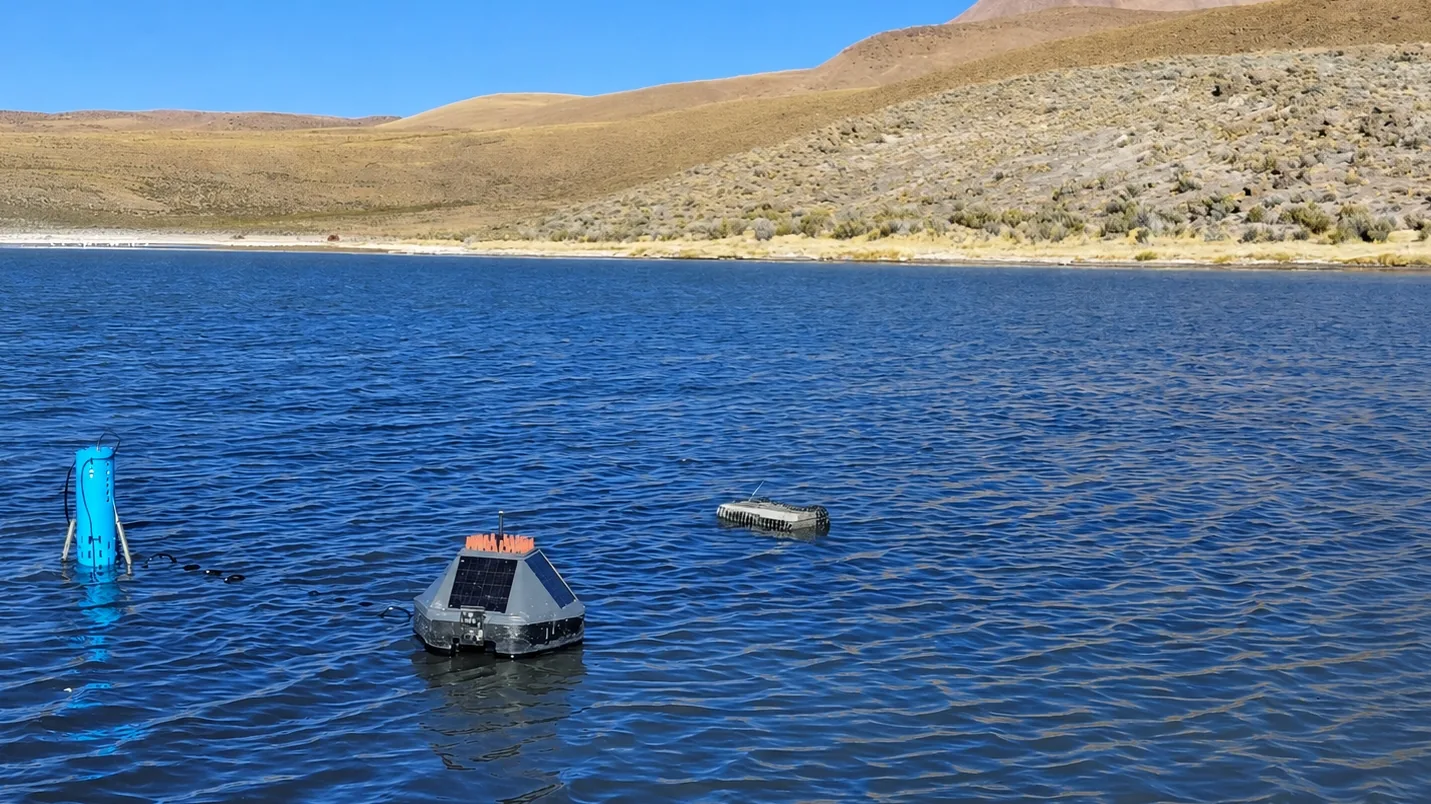
MUSUX was a finalist in KO-UMA-YAKU, a challenge run by Chile's economic development agency (Corfo), Ministry of Science (MinCiencia), and national forestry agency (CONAF). It took measurements in four protected natural areas, from Isluga to Parrillar. See the project
Reference values; the final specification depends on each project's sensors, communications, and integration.
| Solution type | Autonomous water monitoring buoy |
|---|---|
| Dimensions | Approx. 450 × 495 mm (buoy); weight depends on configuration |
| Power | Integrated solar with battery bank |
| Structure | 316 stainless steel exoskeleton with floats; protective cage for the sonde |
| Telemetry | Onboard VigiaBOX with local backup and automatic store-and-forward |
| Sensors | Water quality (IP68 multiparameter sonde, RS-485, 0–50 °C, 6 parameters), echo sounder, level, or others, depending on the project |
| Communications | Cellular, LoRaWAN, MQTT, or HTTP; satellite link depending on the project |
| Integration | Connection Broker: Webhook, REST API, MQTT, Azure Service Bus; scheduled reports; access through Microsoft Entra ID |
| Installation | Ponds, impoundments, process ponds, wetlands, and coastal zones |
Every MUSUX includes configuration, sensor integration, commissioning, platform access, visualization and reporting, operational support, updates, and technical documentation.
No. It is an open, configurable platform: sensors, communications, and data destination are defined by the water body and the system that has to receive the data.
Tailings and industrial water, desalination, oceanography and coastal waters, wetlands, and operational water.
Over cellular, LoRaWAN, or satellite to the Connection Broker, which delivers it to GeoVigía or to your systems via API, MQTT, SCADA, or reports.
VigiaBOX keeps the records on board and resends them when the link returns. As long as there is power, measurement does not stop.
Tailings, wetlands, intakes, discharges, bays, channels, desalination, or oceanography: tell us which water data is not reaching you continuously today.