Case studies / Field experience

From real challenges to technology at work.

Monitoring a heat-traced line at altitude. Observing a pond. Recording traffic far from the power grid.

Four concrete problems, solved with our devices and software.

STANDALONE SPEED CAMERAS
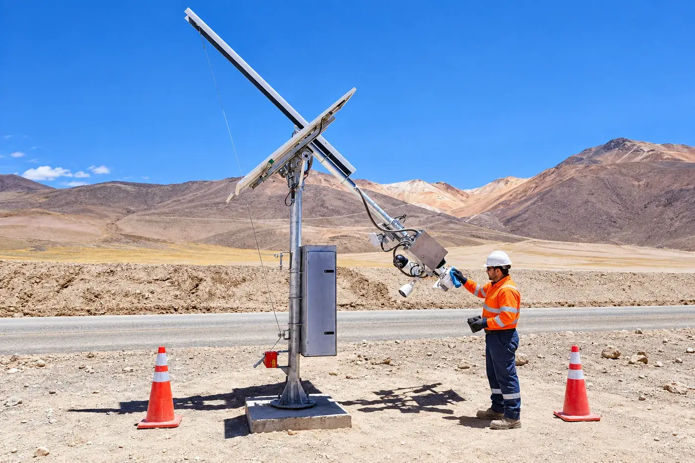
Wolke installation at a mine site

Different projects.
One shared need.

Knowing what is happening in the field and getting that information to the people who need it. Each case study shows the challenge, the technology applied, and the information it delivers.

Operations and assets
Case 01 / Mining

Monitoring heat-traced lines above 4,500 meters.

ThermoGuard and VigiaBOX at a gold and silver mine in the high Andes of northern Chile. Explore ThermoGuard

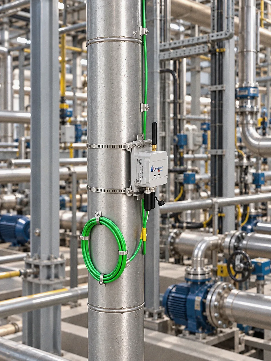
Nodo ThermoGuard fijado con abrazaderas a una tubería de planta, imagen ilustrativa
ThermoGuard installed next to the heat-traced line · illustrative image.
above4.500maslSite altitude, with temperatures down to −30 °C
ThermoGuardMeasurement nodes on the lines
VigiaBOXAggregation and local display

The challenge

Tracking how heat-traced lines (electrically heated pipes) behave at a plant exposed to temperatures down to −30 °C.

The implementation

One hundred ThermoGuard nodes alongside the lines, installed without running cable or stopping the process. VigiaBOX aggregates the readings, and a local display shows them in the field.

The information delivered

The temperature of each line in a monitoring system: which circuit to check first, and how much margin is left before freezing.

Wolke's role

Bringing measurement to every line and turning it into a clear operating status.

Tailings
Case 02 / Water

Observing multiple points across a pond.

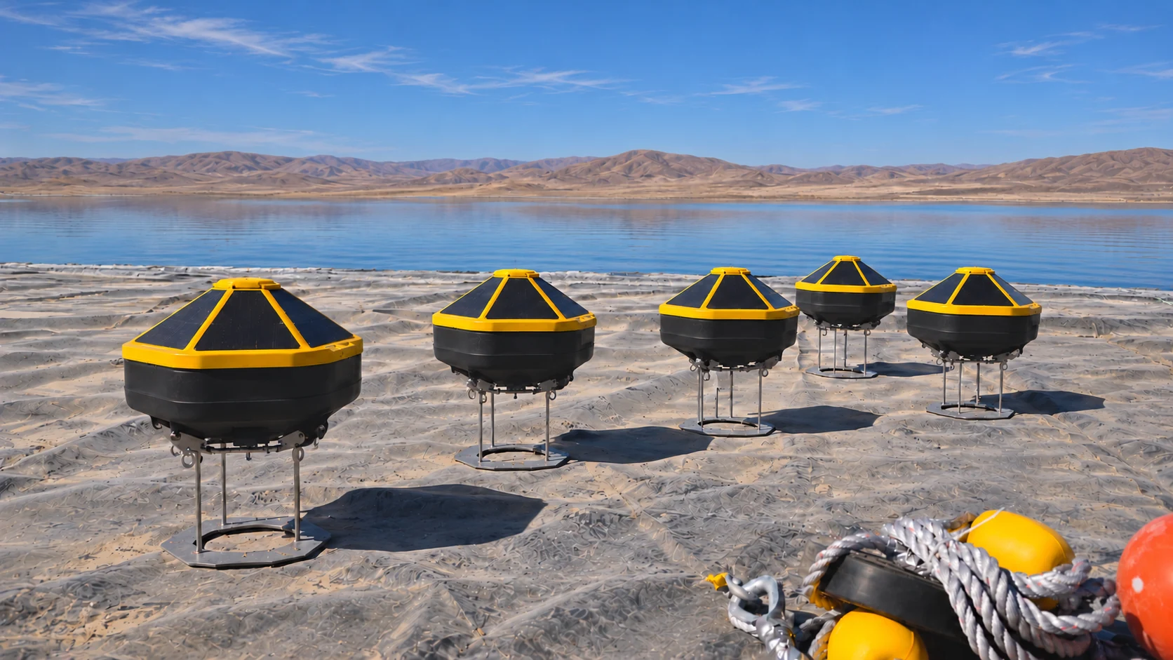
Networks of MUSUX buoys with echo sounders and water quality sensors on tailings ponds.

Boyas MUSUX preparadas para un despliegue en una laguna de relaves
MUSUX network being prepared for deployment.
Multi-unitObservation at multiple points
Water qualityTurbidity, pH, conductivity
Echo soundersLocal depth readings

The challenge

Seeing what changes in the pond between bathymetric surveys, at several points rather than from one isolated reading.

The implementation

Networks of several MUSUX buoys with echo sounders and multiparameter sondes, each with its own power and communications, deployed at the mine site.

The information delivered

Local depth and water quality, comparable over time, with their reference values. Information to guide verification checks and feed the water balance.

Wolke's role

Continuous, distributed observation on the water, between one survey and the next.

A fixed buoy observes defined points; it complements bathymetry but does not replace it.

Operations and assets
Case 03 / Traffic

Recording traffic, far from the power grid.

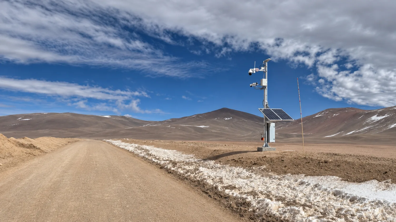
Standalone speed cameras on high-altitude mine roads, with solar power and communications so every event can be reviewed remotely.

The challenge

Keeping speeds in check on high-Andes roads with no power grid and no guaranteed cellular coverage.

The implementation

Seven standalone stations with radar, cameras, solar power, and cellular and satellite communications. AI validates the license plate and direction of travel of each passing vehicle.

The information delivered

Speed, license plate, and images for each event, plus the status of every station. Safety, Operations, and Maintenance review what happened using the same evidence.

Fotorradar autónomo con energía solar en un camino minero con nieve
Wolke installation at a mine site: radar, cameras, and off-grid power.
7 stationsDeployed network
Solar powerMore than 3 days without sun
Cellular + satelliteRedundant communications
Wolke's role

Capture, power, and communications, solved in a single standalone station.

Mining / Water and compliance
Case 04 / MEE

From measurement to the DGA's response.

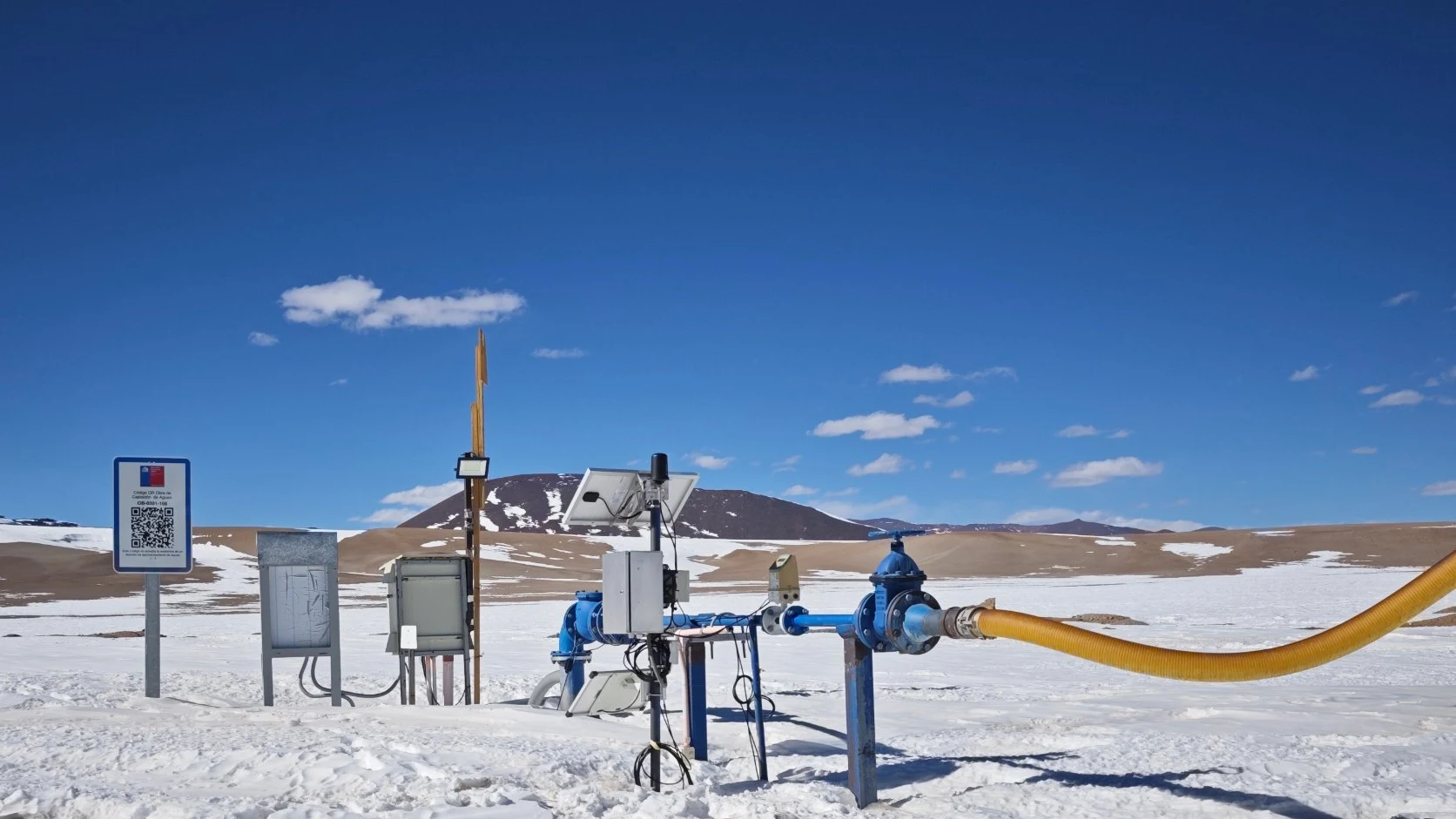
Effective Extraction Monitoring at a mine site above 4,000 masl: every record tracked from the well to the DGA's acknowledgment, with daily reports for operations.

Pozo de extracción con caudalímetro, VigiaBOX y panel solar en una faena con nieve
Operating well at a high-Andes mine site.
01Received
02Normalized
03Validated
04Reported

The challenge

Remote wells with no cellular coverage that must report their extractions to the DGA. Transmitting isn't enough: you need to know what happened to every submission and be able to prove it.

The implementation

Since 2023, VigiaBOX has logged flow, totalized volume, and level every hour and sent them via satellite; anything pending is resent in order. The software keeps the original, validates it, publishes it to the DGA API and stores every response, including errors and retries.

The information delivered

The delivery status of every record, alarms in GeoVigía, and daily reports on operations, extraction versus water rights, and end-of-day closing. The same data can flow to the site's DCS or SCADA.

More than transmitting Effective Extraction Monitoring · Wolke
99,8 %Hours with data, last 12 months
90.000+Records acknowledged and accepted by the DGA
100 %Hours with data, 100 days in a row

The same solution runs in mining and in other sectors with water rights to report.

Wolke's role

Compliance is not just transmitting: it is being able to prove what happened to every record, from the well to the DGA and your own systems.

The technology that connects the cases

The setting changes.
The need for good data doesn't.

See our four solution lines

In all of these projects, measurement does not end at the sensor: it has to be logged, transmitted, and made accessible.

Our devices and software are the common foundation across different variables, instruments, and field conditions.

Explore Wolke technology
Public innovation challenges

Projects that pushed our technology forward.

Two public innovation challenges that took our technology into the field: monitoring aids to navigation and observing wetlands.

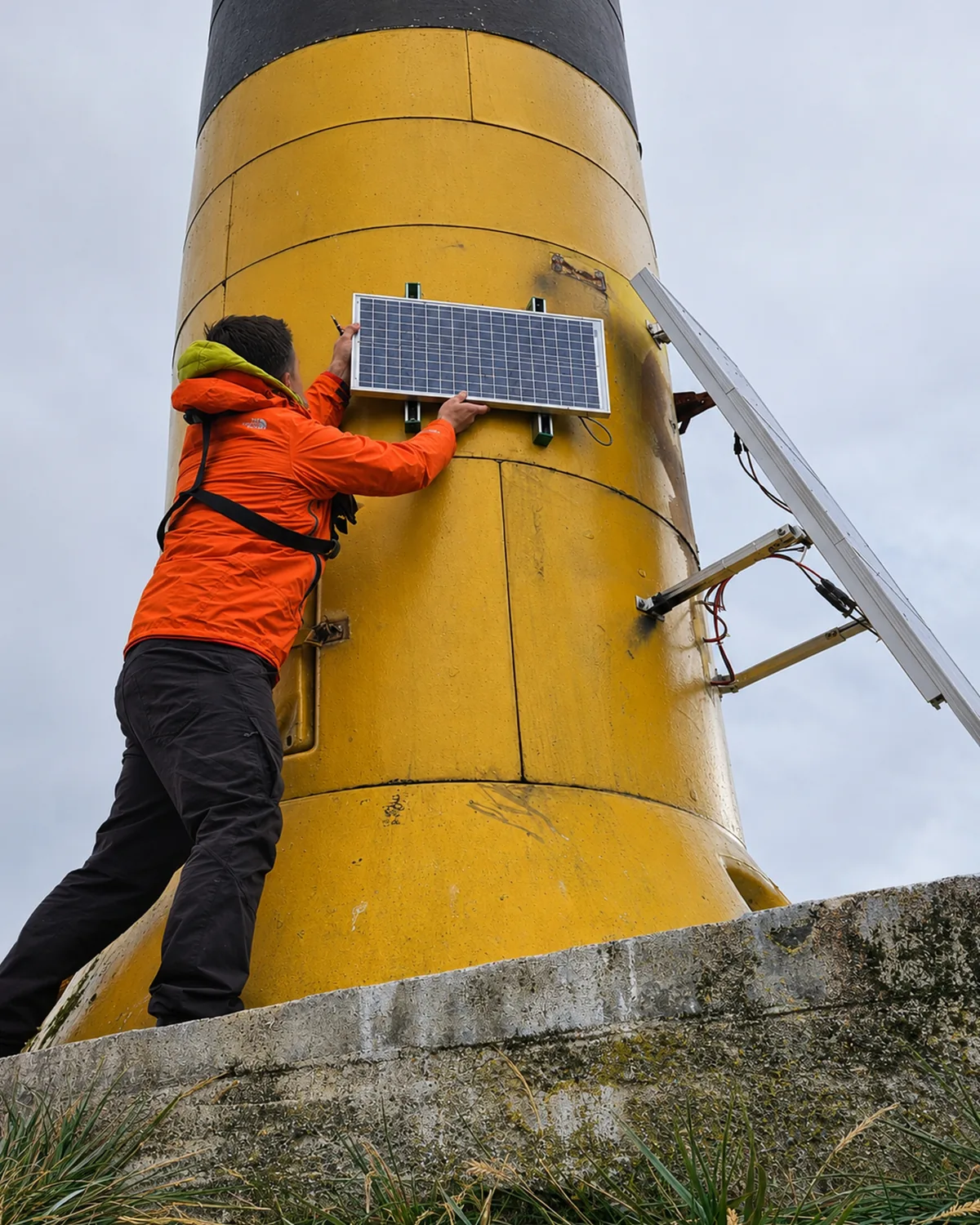
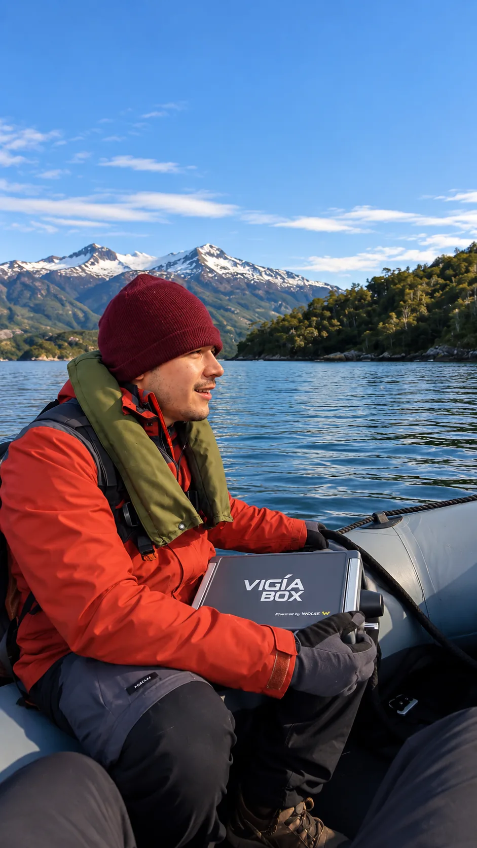
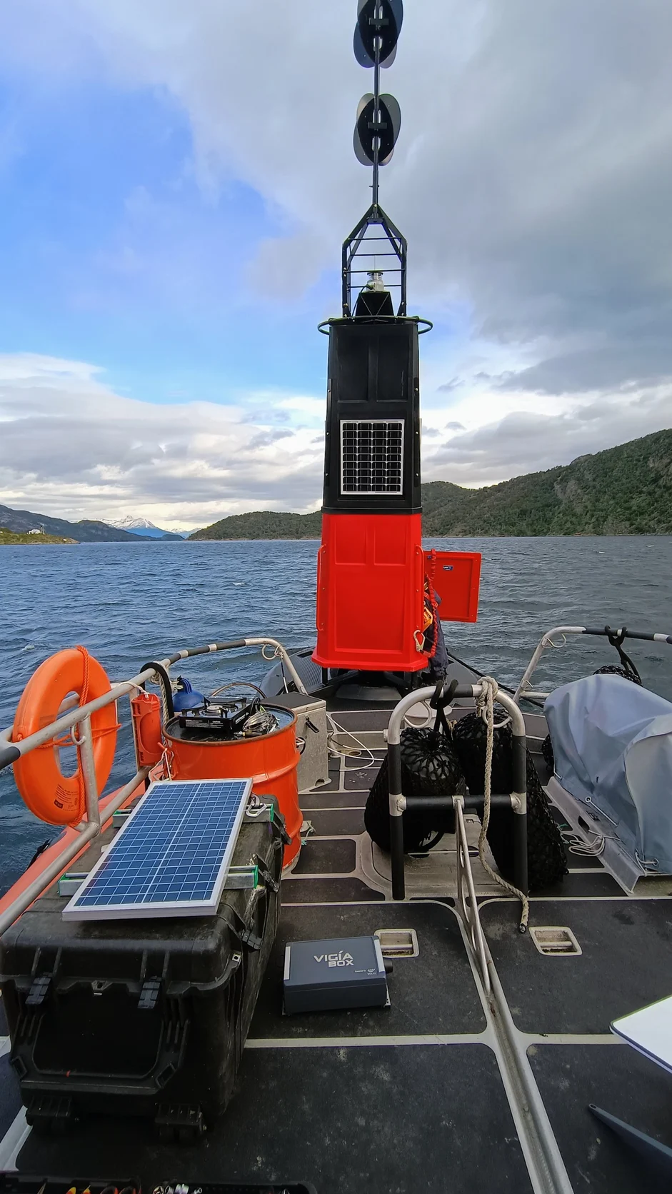
Técnico de Wolke instalando un panel solar en un faro del Canal Beagle Técnico de Wolke con un VigiaBOX a bordo de una embarcación en el Canal Beagle Boya de señalización con Vigía X y un VigiaBOX a bordo de una embarcación en el Canal Beagle
Installation in the Beagle Channel · aids to navigation
PUBLIC INNOVATION CHALLENGE · MINCIENCIA + CHILEAN NAVY
Innova APOLINAV · “Señales en el Mar Austral de Chile” (Signals in Chile's Southern Sea)

Remote monitoring of aids to navigation in Magallanes.

Chile has more than 1,200 aids to navigation, and half of them are in the Magallanes Region, where 90% of the routes through the Strait of Magellan have no cellular coverage. Failures came to light when a mariner reported them, and repairs took days.

In the public innovation challenge launched in 2021 by Chile's Ministry of Science (MinCiencia) and the Naval Polytechnic Academy (APOLINAV), Wolke developed Vigía X: a self-contained circuit that logs the current, energy, light output, and faults of each aid to navigation without modifying the equipment, and sends that data to the Zonal Maritime Signaling Centers. The system was tested in Chile's far south from late 2023 into 2024, and lighthouse keepers at the Magallanes Zonal Center were trained to operate it.
MinCiencia · ANID Public Challenges Program · ANID
Armada de Chile APOLINAV · Maritime Signaling Service
See the DIRECTEMAR publication Call for proposals · Chilean Navy
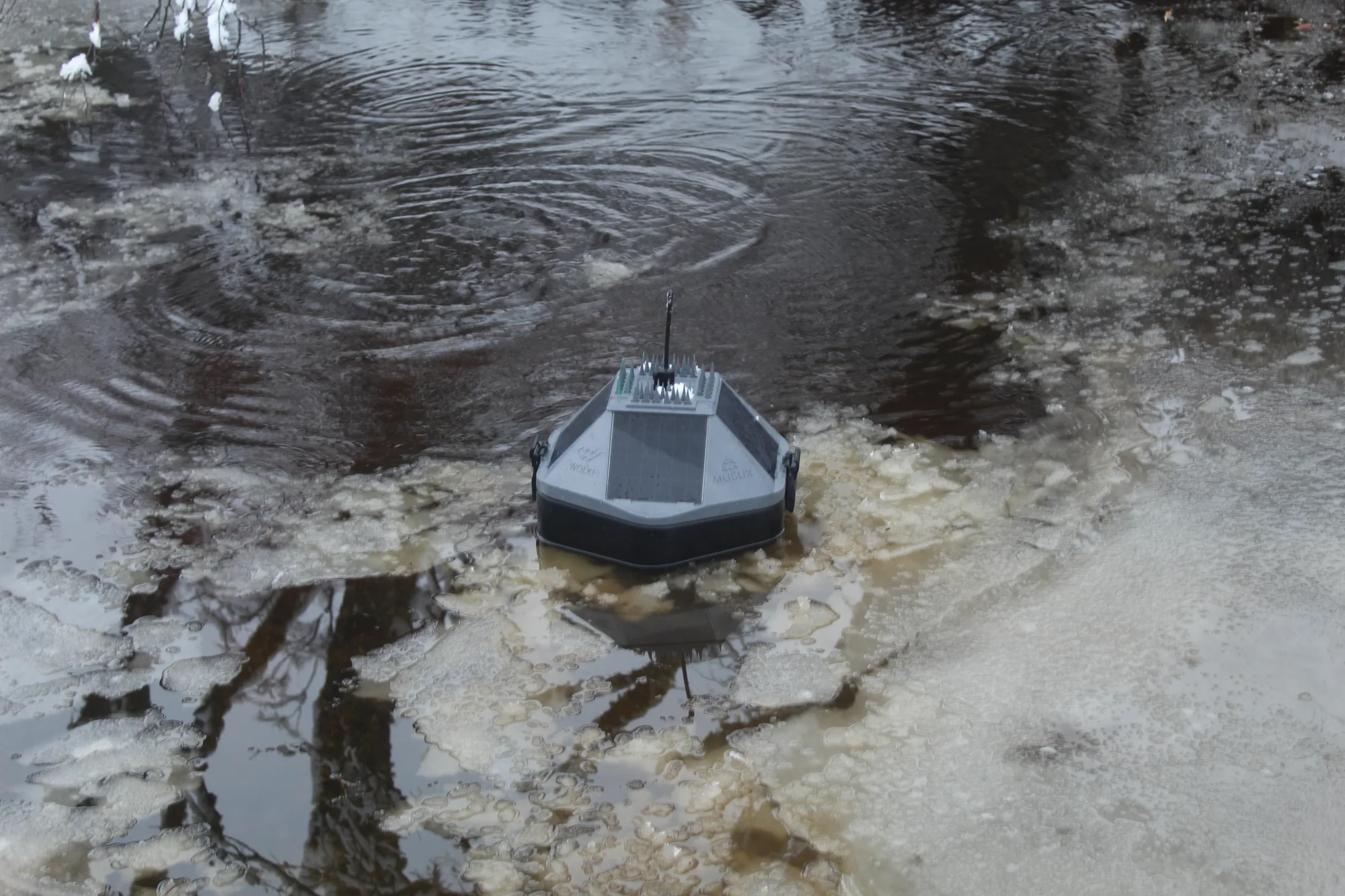
Boya MUSUX operando en un cuerpo de agua con hielo
MUSUX · monitoring in cold conditions
PUBLIC INNOVATION CHALLENGE · CORFO + MINCIENCIA + CONAF
KO-UMA-YAKU · Monitoreo de humedales

Water data to conserve protected wetlands.

CONAF, Chile's national forestry agency, needed to measure the water in its protected natural areas continuously and in a standardized way, at low cost and without relying on site visits. The challenge drew 44 applications; MUSUX was one of the five selected and one of the two that reached the final stage.

After 30 days of continuous validation at Laguna Torca National Reserve, MUSUX measured conductivity, dissolved oxygen, pH, temperature, and level in four CONAF protected areas—Volcán Isluga, Nevado de Tres Cruces, Laguna Torca, and Laguna Parrillar—from the Altiplano to Magallanes. Developed by Wolke with Universidad de Playa Ancha and Stout.

Proyecto apoyado por Corfo Public Innovation Challenge · MinCiencia
CONAF Four protected natural areas
See the Ministry of Science publication Validation at Laguna Torca · Corfo and CONAF Maule
Let's talk

A similar challenge at your operation?

Tell us what you need to measure, where the site is, and what information is missing.

Let's talk about your project We can build on your existing instruments and systems.